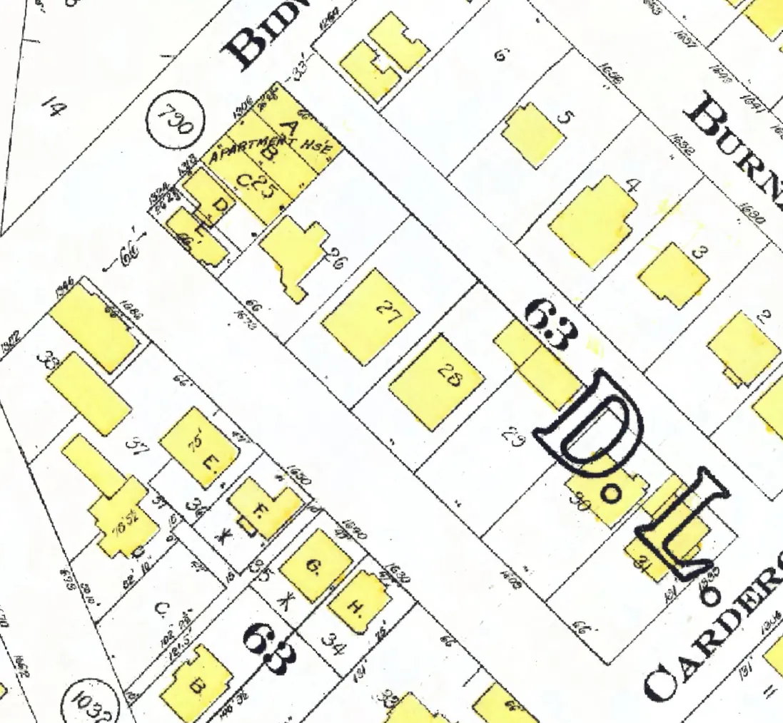
124 addresses on seven blocks of Harwood Street in West End, as the 1940 city directory lists them, with everyone its name section puts at each and what stands there today.
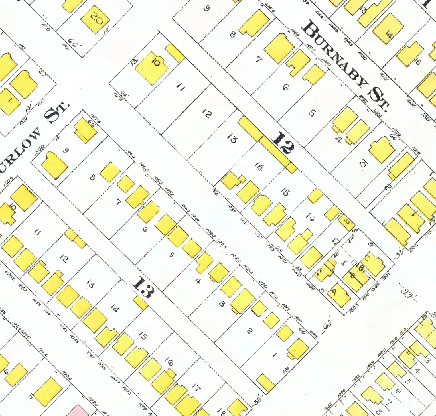
The 1000 block
The 1000 and 1100 blocks lie together between Burrard and Bute Streets. 26 addresses in the 1940 directory; none of them still has its pre-1946 building. Tap a line to open its house.
Harwood Street, the 1000 blockas the 1940 directory lists it, door by door, and what stands there today
*: some member of the family owns the property, to the best of our knowledge (the directory's own mark, printed from 1935)
East side, odd numbers
West side, even numbers
- 1006Taylor J Mgone
- 1010Pond Mrs H Jgone
- 1012Roy Mrs Agone
- 1014*Middleton Tgone
- 1020Killip T L +3rebuilt
- 1024B C Window Clnrs +1gone
- 1026Robertson R B +1gone
- 1028Bell Mrs A L +1gone
- 1030Mynott A A +1rebuilt
- 1040Mathieson Mrs Egone
- 1046*Wellman T Jgone
- 1052Badman Mrs Agone
- 1056Parkes L Cgone
- 1058Jodelite Fgone
- 1066Nordman Estands
- 1078Randall Mrs Egone
The 1100 block
The 1000 and 1100 blocks lie together between Burrard and Bute Streets. 37 addresses in the 1940 directory; two still have their pre-1946 buildings. Tap a line to open its house.
Harwood Street, the 1100 blockas the 1940 directory lists it, door by door, and what stands there today
East side, odd numbers
- 1101Haikala Miss Hrebuilt
- 1109*Smith F Hstands
- 1115McLennan M M Kgone
- 1117Mackness R Rstands
- 1121Stewart Mrs Erebuilt
- 1133*Poole Frebuilt
- 1143*Summers S Agone
- 1147Hansen Tgone
- 1149Webber Cgone
- 1155Marpole Mrs K Arebuilt
- 1157*Solloway L Tgone
- 1161Hooper Mrs M Agone
- 1165*Dods P Dgone
- 1169Carlisle J Rgone
- 1185Margaret Convalescent & Nursing Homegone
West side, even numbers
- 1112Nichol Mrs Ngone
- 1116Clyde Apts +4gone
- 1118Harwood Lodge +1gone
- 1120Formby Mrs M Lgone
- 1122Byrne Jrebuilt
- 1124Brown J Rgone
- 1126Norman H Lgone
- 1128White E Ogone
- 1130Orr Mrs Cgone
- 1132Skaling A Cgone
- 1134Rose E Ggone
- 1136Tucker Jgone
- 1138Bryne Mrs Egone
- 1142Williamson E Pgone
- 1146Thomson Frebuilt
- 1148Peterson N Cgone
- 1156*Hoggan T R Rgone
- 1160*Paterson Hgone
- 1164Strang W +1gone
- 1170*Armstrong Mrs L Vrebuilt
- 1176Crossley Lgone
- 1186*Gordon G Fgone
The 1200 block
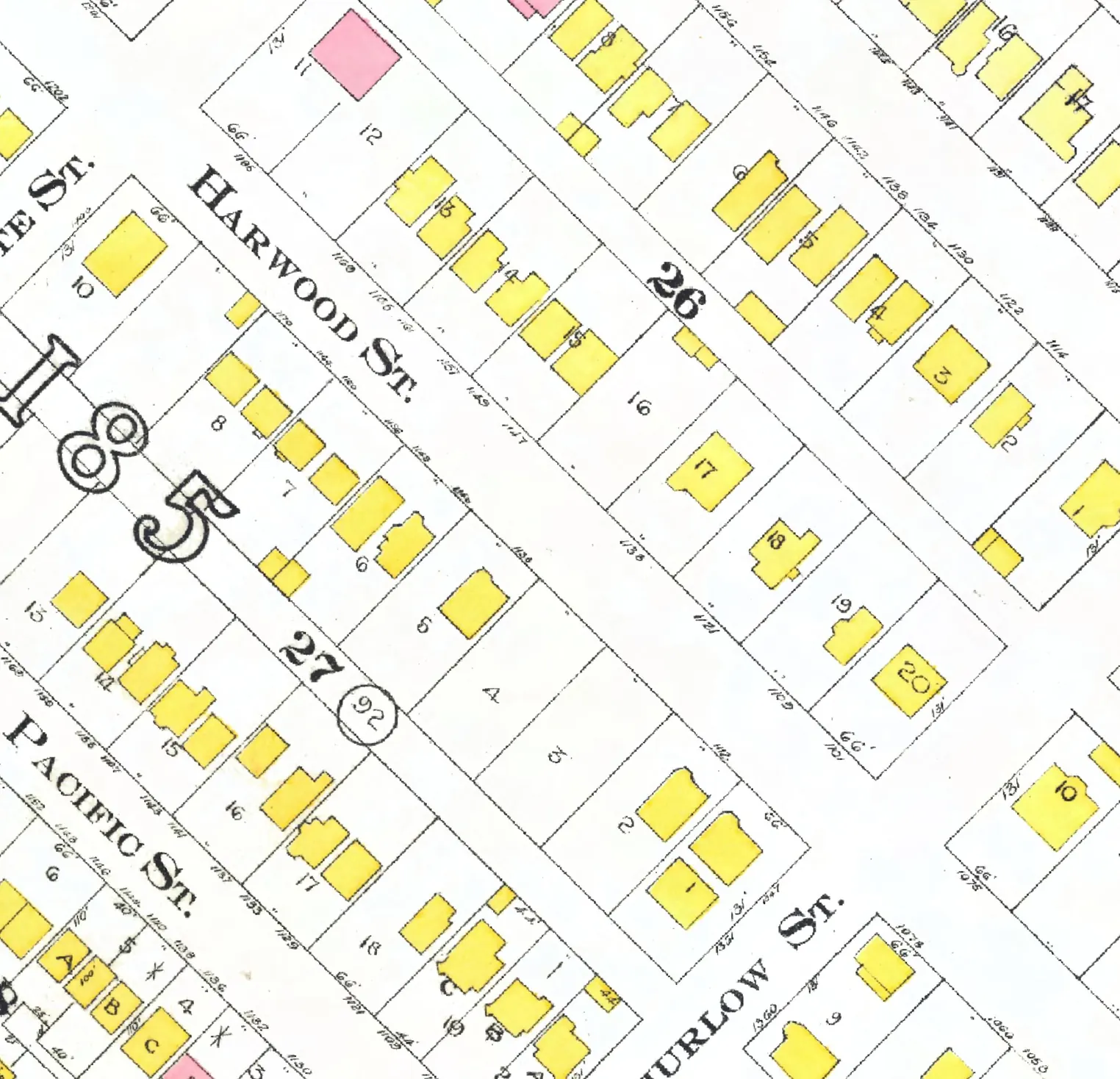
Between Bute and Jervis Streets. Nine addresses in the 1940 directory; one still has its pre-1946 building. Tap a line to open its house.
Harwood Street, the 1200 blockas the 1940 directory lists it, door by door, and what stands there today
East side, odd numbers
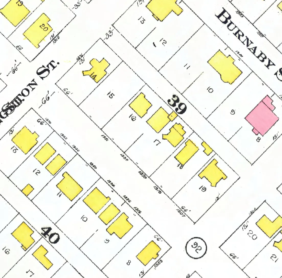
The 1300 block
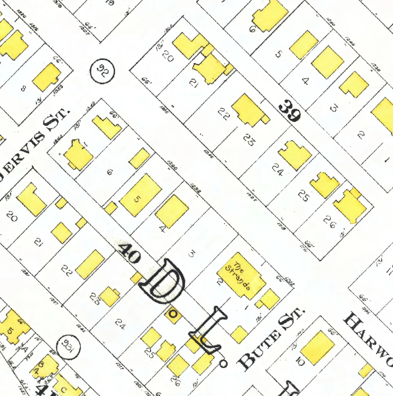
Between Jervis and Broughton Streets. 19 addresses in the 1940 directory; none of them still has its pre-1946 building. Tap a line to open its house.
Harwood Street, the 1300 blockas the 1940 directory lists it, door by door, and what stands there today
East side, odd numbers
The 1400 block
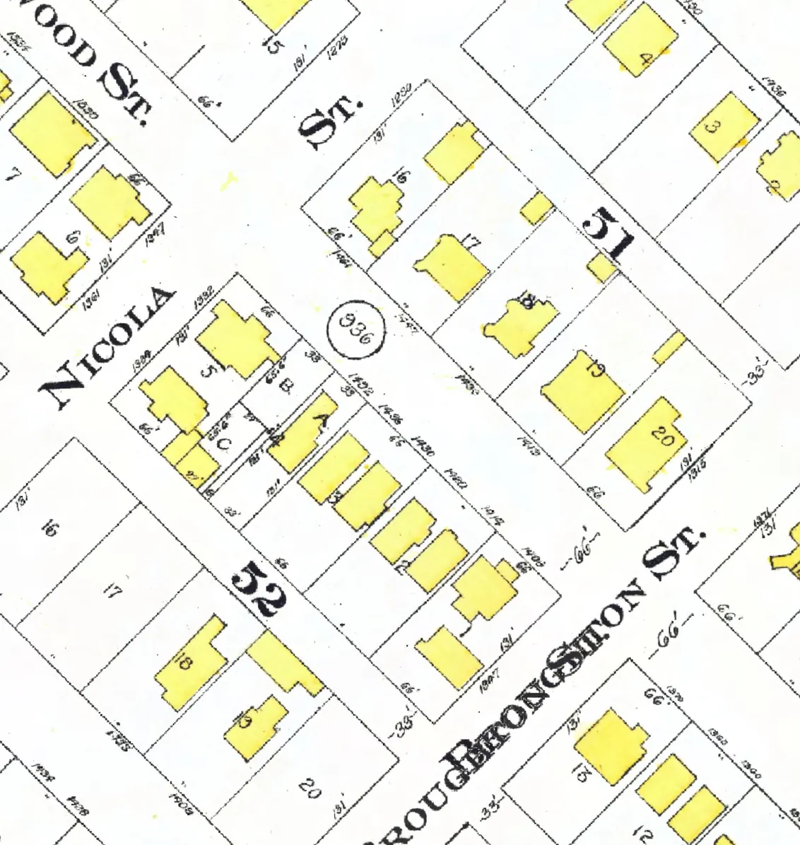
Between Broughton and Nicola Streets. Eleven addresses in the 1940 directory; two still have their pre-1946 buildings. Tap a line to open its house.
Harwood Street, the 1400 blockas the 1940 directory lists it, door by door, and what stands there today
East side, odd numbers
The 1500 block
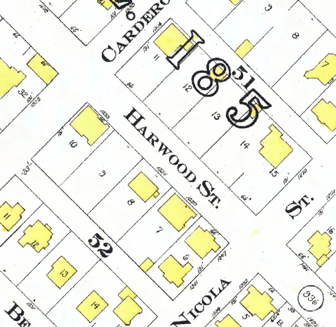
Between Nicola and Cardero Streets. Five addresses in the 1940 directory; two still have their pre-1946 buildings. Tap a line to open its house.
Harwood Street, the 1500 blockas the 1940 directory lists it, door by door, and what stands there today
East side, odd numbers
West side, even numbers
The 1600 block
Between Cardero and Bidwell Streets. 17 addresses in the 1940 directory; none of them still has its pre-1946 building. Tap a line to open its house.
Harwood Street, the 1600 blockas the 1940 directory lists it, door by door, and what stands there today
East side, odd numbers