Strathcona, Vancouver
The 600 block
6 addresses, in the 1906, 1908, 1909, 1910, 1911, 1912, 1913, 1915, 1920, 1925, 1930, 1935, 1940 and 1945 city directories
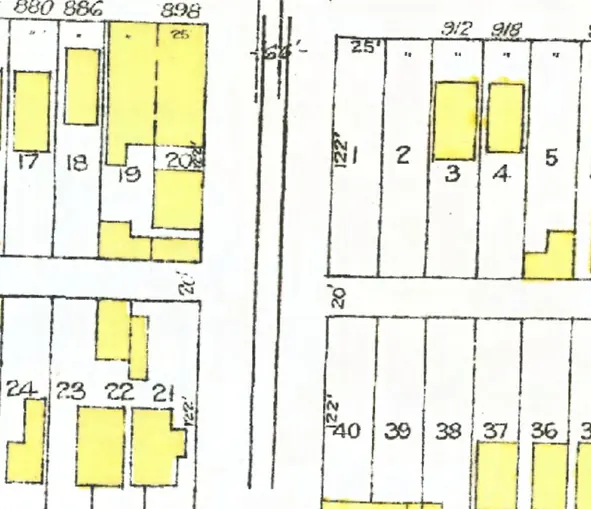
The 600 block of Campbell Avenue in Strathcona, door by door, as each year we've read lists it (1905–1913, 1915, 1920, 1925, 1930, 1935, 1940 and 1945; pick one below), with what stands at each address today.
The 500 and 600 blocks lie together between Keefer and East Georgia Streets. Six addresses in the 1906, 1908, 1909, 1910, 1911, 1912, 1913, 1915, 1920, 1925, 1930, 1935, 1940 and 1945 directories; one still has its pre-1946 building. Tap a line to open its house.
Campbell Avenue, the 600 blockas the 1907 directory lists it, door by door, and what stands there today
The 1905 directory lists no one on this block.
The 1907 directory lists no one on this block.
West side, odd numbers
- 601vacantnot listednot listedButler Thomas H +1Butler Thomas HButler Thomas HButler Thos HLynn E MJenkins Mrs Elizabeth +1Caltman Mrs Annie +1Erickson Mrs E +1Jugo-Slav Can Benev Soc +1Holm G +1Price G +5Rizun Mrs P +4gone
- 603Butler, Thos. H.not listedLewis & Milborne real estate +1Battistani Gustavo +1Battistani GustavoMarvis JohnMarvis JohnMarvis JohnCouvalias ECollinge JamesCollinge JCollinge Jnot listednot listednot listedgone
- 665Winnipeg GroceryWinnipeg Grocerynot listednot listednot listednot listednot listednot listednot listednot listednot listedgone
- 675McBride F Wnot listednot listednot listednot listednot listednot listednot listednot listednot listednot listednot listedgone
Since 1945
- 1961The City's Redevelopment Project 1 (area A-1.1) puts the east side of the block inside a clearance area, and the City's later maps show the old lots gone. (inferred) (LEG1350.02, undated, about 1961)
- 1961The City's Redevelopment Project 1 (area A-1.1) marks 600 Campbell Avenue as excluded from the project. (inferred) (LEG1350.02, undated, about 1961)
- 1968The west side of the block is inside the boundary of the City's Urban Renewal Scheme 3 (Strathcona I). The boundary alone doesn't say which blocks were to be cleared. (LEG37.28, dated Aug. 1968)
The urban-renewal plans: City of Vancouver Archives, each record linked on its line; the plans and maps are under the City's copyright, so we tell what they show and don't reproduce them.