A family book
The Doerings
Vancouver
1907–1913
The Doerings
A family book
Everyone named Doering in Vancouver's city directories from 1907 to 1913, one person at one address, read line by line, with the page behind every line
Contents
- The name
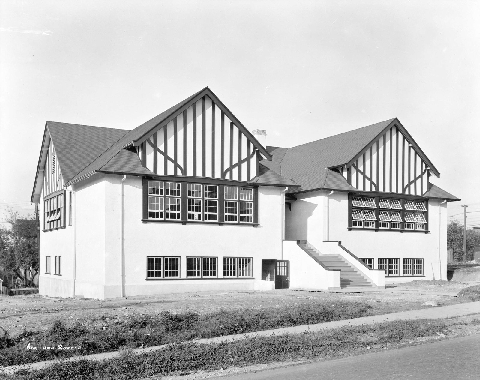
- Plate I, an archive photo2 April 1930
- I262 East 6th Avenue1907–1913
- Plate II, the name on today's map
- The addresses today
- Sources, page by page
AddressLore, Vancouver, 2026
Prologue
The name
The directories print one person named Doering at one address, 262 East 6th Avenue in Mount Pleasant, in 1907, 1908, 1909, 1910, 1911, 1912 and 1913.
Each chapter is one address: the people printed there with their work, the story there in our words, and each year's lines as the directory printed them, with who lived next door. Where the same first name and initials appear at two addresses, we follow the person from one to the next and say so; that is an inference, and marked as one.
Plate I
Chapter I
262 East 6th Avenue
Mount Pleasant, 1907 to 1913
In 1907, 1908, 1909, 1910, 1911, 1912 and 1913 the directory lists Charles Doering, a brewer, at 262 East 6th Avenue.
- Charles Doering
- A brewer, 1907, 1908, 1909, 1910, 1911, 1912 and 1913
Plate II
Epilogue
The addresses today
The City no longer lists 262 East 6th Avenue, so that building is probably gone (inferred).
The directories in this book stop in 1913; names are shown through 1945. What they printed under the Doering name is in the chapters before this one, every line with its page, so anyone can check it.
Sources
The page behind every line
Every year here comes from that year's printed city directory, held by the Vancouver Public Library. Canvassers compiled each one door to door, so a listing is who they recorded, not a legal record. Names are copied as printed, spellings and all. The street section lists each address in order; the name section lists each person with their work and address, which is where the jobs come from. h marks a householder, r someone living there, wid a widow. *: some member of the family owns the property, to the best of the directory's knowledge (its own mark, printed from 1935).
Close spellings of the name are grouped, since a family's name was often spelled differently from one year to the next; one name can still be several families, and we join lines only where the first names or initials agree. Many Chinese, Japanese and other residents weren't named by the canvassers, so they can't be found by name. We link the library's page images and never reprint them.
Pages cited
- 1907Henderson's City of Vancouver Directory: street section p. 259
- 1908Henderson's City of Vancouver Directory: street section p. 347
- 1909Henderson's City of Vancouver Directory: street section p. 424
- 1910Henderson's City of Vancouver and North Vancouver Directory Part 1: street section p. 185
- 1911Henderson's Greater Vancouver New Westminster and Fraser Valley Directory: street section p. 396
- 1912Henderson's Greater Vancouver Directory Part 1: street section p. 130
- 1913Henderson's Greater Vancouver City Directory Part 1: street section p. 164


Today's buildings and the map: City of Vancouver open data, under the Open Government Licence – Vancouver. The photograph: City of Vancouver Archives, CVA 99-3785, public domain.
Something wrong, or a name you'd like removed? Tell us.
Compiled by AddressLore, Vancouver, November 2026. Set in Libre Caslon.